Land Seismic Refraction
The Seismic Refraction technique entails measuring the travel times of seismic compressional waves (P-waves) produced on the surface.
Applications
- Cartography of bedrock
- Mapping of weathered zones
- Stratigraphic mapping
- Estimation of material firmness for activities like piling, tunnelling, and excavation activities
- Detection of faulted or fractured zones
Method
The Seismic Refraction technique includes measuring the travel times of seismic compressional waves (P-waves) produced on the surface, traveling through the subsurface, and returning to the surface after refraction at the interface between layers with differing seismic velocities. The velocities of seismic waves are influenced by the fundamental characteristics of elastic strength and density of the material through which they propagate.
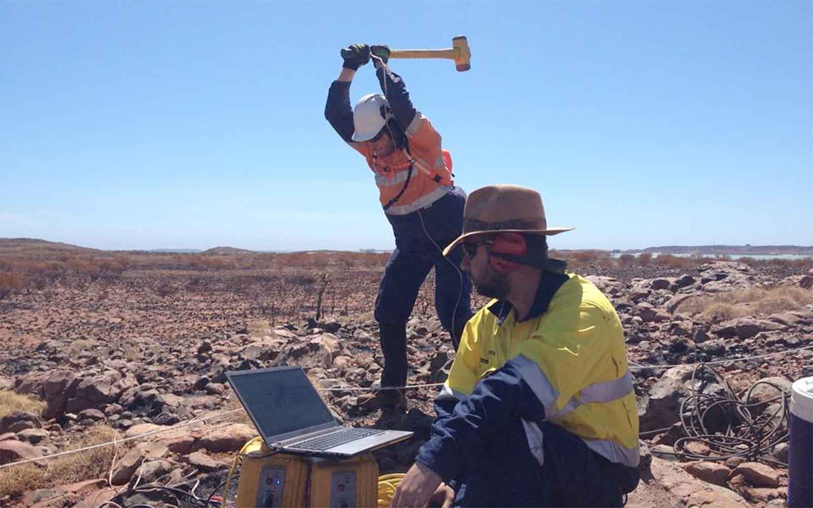
In near-surface examinations, seismic energy is produced on the surface through a sledgehammer. Deeper investigations necessitate more potent sources like accelerated drop weights, downhole airguns, or explosives. The resulting seismic waves travel through the subsurface at a particular velocity. Upon encountering a geological boundary characterized by an uptick in seismic velocity, the wave undergoes critical refraction at a specific angle and travels along the upper surface of the lower layer at an increased velocity. This process generates head waves in the upper layer, which return to the surface and are detected as vibrations by a linear array of geophones positioned at regular intervals.
Through measuring the travel times of refracted waves from numerous source points to various receivers, the seismic refraction technique can discern lateral variations in the depth to the upper boundary of a refracting interface and the seismic velocity within it. Additionally, as they are linked to elastic strength and density, the velocities derived from a seismic refraction survey can serve as a valuable indicator for assessing the ease of rock rippability during excavation.
Data Analysis & Presentation
The processing and analysis of seismic refraction data can be conducted by employing a layered model, assuming well-defined refractive boundaries, or a tomographic approach, presuming a gradual elevation in seismic velocity with depth. Both methodologies offer advantages and are commonly employed together to produce the most comprehensive geological model achievable.
The result is a cross-sectional representation revealing lateral variations in the depth to distinct refracting interfaces and the associated seismic velocities. When correlated with core logs, this data can be linked to geological boundaries in the subsurface. Such correlations are especially valuable for excavation planning, as the depth to different layers provides insights into the amount of rock to be removed, and the seismic velocities offer indications of the rock's hardness and, consequently, its rippability.
Featured Work
GBG explores an extensive variety of structures, encompassing historically important buildings to smaller private residences.


Enquire Now
Complete the form below, call us at +1 917 297 0913 (New York office), +1 805 393 2021 (Boulder CO office) or +1 310 745 9301 (Los Angeles office). A member of the team will respond ASAP to discuss your requirements.
Please note: GBG Group is compliant with the General Data Protection Regulation (GDPR). To learn more about how we collect, keep, and process your private information in compliance with GDPR, please view our privacy policy. *
Contact Us
