Land Magnetometry
A passive geophysical technique based on the detection of contrasts in the magnetic properties of different materials in both terrestrial and marine environments.
Applications
- Geological mapping, including ore body, dyke and fault delineation
- Terrestrial and marine archaeological investigations
- Detection of unexploded ordinances
- Detection of buried ferrous objects
- Mapping of underground infrastructure, including UST’s
Method
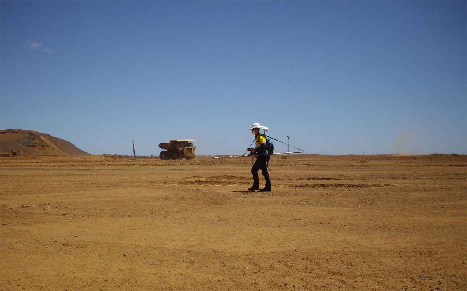
Magnetometry is a passive geophysical technique based on the detection of contrasts in the magnetic properties of different materials in both terrestrial and marine environments. The magnetic response from naturally occurring rocks is due to the presence of the most common magnetic mineral, magnetite or its related minerals. Of environmental and archaeological significance, magnetic responses are observed in fired bricks which obtain a magnetic field during the cooling process, and from man-made ferrous objects including unexploded ordnance and scrap metal.
Magnetic systems can be composed of a single sensor (total field magnetometer) or dual sensors (magnetic gradiometer). With a single sensor array, bulk changes in magnetic response are detected and can be plotted to map variations across a site. Fixed base station data is then used to remove natural diurnal variations in the earth’s magnetic field. With a dual sensor gradiometer array, sensors are orientated vertically in order to measure small variations in the local magnetic field.
The bottom sensor is closer to the subsurface is typically affected more by near-surface anomalies, whilst the top sensor gives the broader magnetic response of the subsurface. The magnetic vertical gradient can be calculated from the two sensors giving a more precise representation of the magnetic response in the near-surface, and also helping to negate diurnal variations.
Data Analysis & Presentation
Magnetic anomalies are composed of a positive and negative part known as a magnetic dipole. Its shape is related to the structural geometry of the object as well as its direction of magnetisation, and the regional magnetic field. The characteristics of an anomaly also depend on the depth of the object with increased depth resulting in broader, lower amplitude anomalies.
The results of a magnetometer investigation are presented as “heat maps” showing the variation in the measured magnetic response. These are analysed for targets of interest with spatial positioning, the approximate dimensions and depth being extracted.
Featured Work
GBG investigates a wide range of structures from historically significant buildings to small private residences.


Enquire Now
Complete the form below, call us at +1 917 297 0913 (New York office), +1 805 393 2021 (Boulder CO office) or +1 310 745 9301 (Los Angeles office). A member of the team will respond ASAP to discuss your requirements.
Please note: GBG Group is compliant with the General Data Protection Regulation (GDPR). To learn more about how we collect, keep, and process your private information in compliance with GDPR, please view our privacy policy. *
Contact Us
