Rectified Photography & Verticality Assessment
Projects: Work Methods/Documentation - Rectified Photography & Verticality Assessment
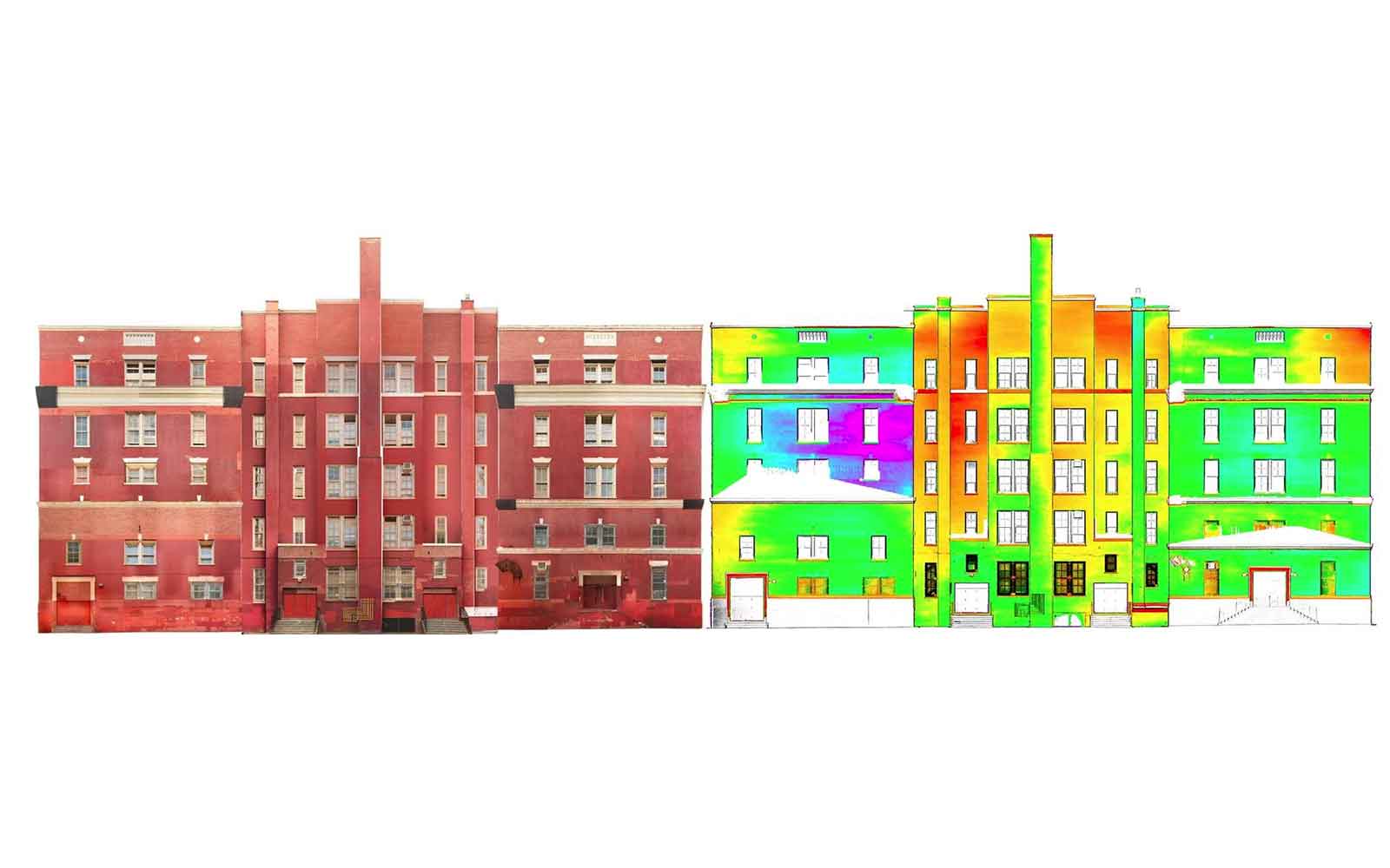
Historic facade (left) collected using rectified photographs from ground level.Verticality contour plot (right) showing the verticality derived from point cloud data. This quantifies variations in verticality across the facade and pinpoints local deformations.
MORE PROJECTSFeatured Work
GBG investigates a wide range of structures from historically significant buildings to small private residences.

Contact Us
